Connecticut
State Motto
Qui transtulit sustinet (He who transplanted still sustains)
Connecticut State Information
Connecticut, located in the New England region of the northeastern United States, is a state known for its rich historical heritage and vibrant modern culture. Nicknamed the "Constitution State" due to its early adoption of the Fundamental Orders in 1639, often considered one of the first written constitutions in history, Connecticut played a pivotal role in the American Revolution and early industrialization. The state is characterized by picturesque landscapes, including rolling hills and a scenic coastline along Long Island Sound. Its cities, such as Hartford, Bridgeport, and New Haven, are centers of commerce, education, and innovation, with a diverse population contributing to its dynamic arts, cuisine, and academic scenes. Connecticut's high standard of living and proximity to major metropolitan areas like New York City make it an attractive place to live and work, while its historical sites, including Mark Twain's home and Yale University, add to its cultural allure.
What's in a name?
Derived from the Algonquian word 'quinatucquet,' meaning 'upon the long river.'
Connecticut Geography

| Area: | 5,543 sq mi (14,356 km²), 48th |
| Highest Point: | Mount Frissell - South Slope; 2,386 ft (222 m), 36th |
| Lowest Point: | Long Island Sound; Sea Level, 0 ft (0 m) |
| Bordering States: | Massachusetts, New York, Rhode Island |
| Area Codes: | Area Codes of Connecticut |
| Zip Codes: | Zip Codes of Connecticut |
Connecticut is characterized by diverse geography. It's a relatively small state, but it boasts a varied landscape, from its picturesque coastline along Long Island Sound to rolling hills, fertile river valleys, and densely forested areas inland. The state's western border is defined by the Housatonic River, and the Connecticut River flows through its central and eastern portions. Connecticut's climate varies from a temperate maritime climate along the coast to a slightly more continental climate inland. The state's geography has historically supported industries such as agriculture and manufacturing, making it a crucial part of the New England region's economic and cultural fabric.
Connecticut Economy
Connecticut boasts a diverse and robust economy driven by a mix of industries. Historically known for its strong ties to finance and insurance, the state is home to numerous major financial institutions and insurance companies, contributing significantly to its economic stability. Additionally, Connecticut's manufacturing sector, particularly in aerospace and advanced manufacturing, plays a crucial role in the state's economy. The presence of prestigious educational institutions fosters a thriving healthcare and biotechnology sector. Real estate and tourism further bolster the state's economic vitality. However, Connecticut does face challenges, including high living costs and fiscal pressures, which have led to ongoing discussions about tax policies and economic growth strategies.
Agriculture
Top 3 crops / livestock for Connecticut
- Dairy
- Greenhouse/Nursery
- Apples
Industry
Top 3 industries for Connecticut
- Finance
- Insurance
- Healthcare
Connecticut State Symbols
State Flag

State Seal

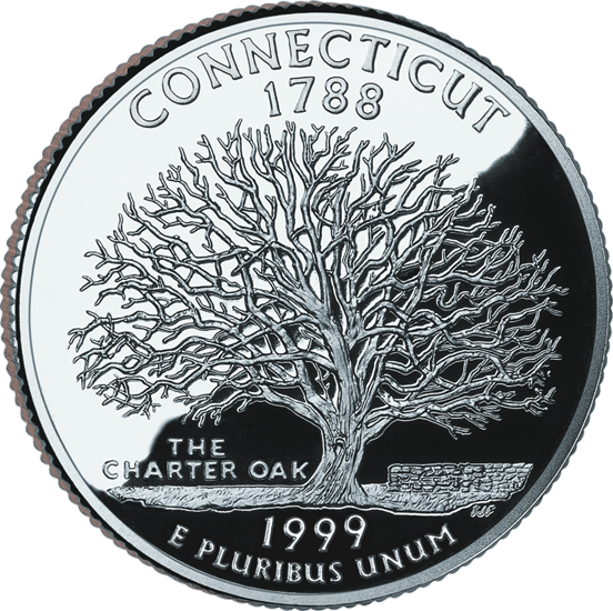
State Quarter
State Bird
 Robin
Robin
State Flower
 Mountain Laurel
State Tree
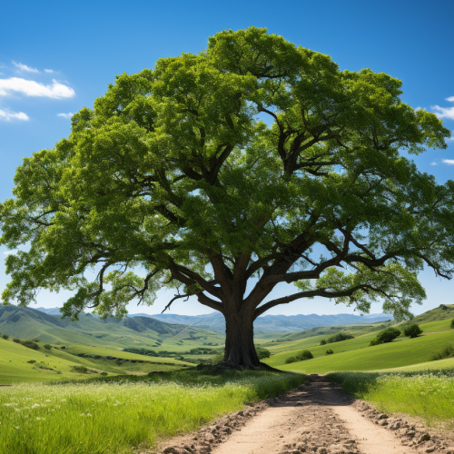 White Oak
State Mammal
 Sperm Whale
State Fish
 American Shad
State Insect
 European Praying Mantis

Ted Grajeda
The50UnitedStates.com Owner
The 50 United States is a Ted Grajeda project created to provide everyone with a fun and interactive way to learn about the great 50 states of the USA. Learn more
State Quizzes & Flashcards
Test your knowledge of the 50 States of the USA with these fun and interactive quizzes & flashcards!


Fee USA Maps
Download and printout hundreds of state maps. Each state map comes in PDF format, with capitals and cities, both labeled and blank. Visit FreeVectorMaps.com for thousands of free world, country and USA maps. View all USA Maps