Colorado
State Motto
Nil sine numine (Nothing without providence)
Colorado State Information
Colorado, often referred to as the "Centennial State," is a landlocked state located in the western United States. Renowned for its breathtaking Rocky Mountain landscapes, Colorado boasts some of the highest peaks in the country, including the iconic Pikes Peak. The state is celebrated for its outdoor recreational opportunities, offering world-class skiing in the winter and hiking, biking, and camping in the summer. Denver, the capital and largest city, serves as the economic and cultural hub, while other cities like Boulder and Colorado Springs contribute to the state's diverse and vibrant communities. With a strong emphasis on sustainability, Colorado is a leader in environmental conservation and is known for its progressive policies. It's also famous for its craft breweries, diverse cuisine, and a rich cultural scene that embraces the arts and the great outdoors.
What's in a name?
Named after the Colorado River, which means 'colored red' in Spanish, referring to the river's sediment.
Colorado Geography

| Area: | 104,094 sq mi (269,603 km²), 8th |
| Highest Point: | Mount Elbert; 14,440 ft (1,342 m), 3rd |
| Lowest Point: | Arikaree River; 3,317 ft (308 m) |
| Bordering States: | Arizona, Kansas, Nebraska, New Mexico, Oklahoma, Utah, Wyoming |
| Area Codes: | Area Codes of Colorado |
| Zip Codes: | Zip Codes of Colorado |
Colorado is characterized by its stunning and diverse geography. The state is renowned for its majestic Rocky Mountains, which dominate the western half of the state and include numerous peaks exceeding 14,000 feet (known as "Fourteeners"). These mountains are a playground for outdoor enthusiasts, offering world-class skiing, hiking, and mountaineering opportunities. To the east, Colorado transitions into the High Plains, a vast region of rolling grasslands. The state is bisected by the Arkansas River and the Colorado River, with the latter carving out the dramatic Grand Canyon of the Colorado in the southwest. Colorado's geography also features numerous canyons, plateaus, mesas, and high-altitude alpine lakes, making it a diverse and visually captivating state.
Colorado Economy
The economy of Colorado is characterized by a diverse and robust mix of industries that contribute to its vitality. Historically known for its agriculture and mining sectors, Colorado has transformed into a dynamic and innovative economy driven by technology, aerospace, renewable energy, and outdoor recreation. The state hosts a thriving tech scene in cities like Denver and Boulder, with a concentration of startups and established companies. Additionally, Colorado's aerospace industry is a major player in national defense and space exploration. The state's renewable energy sector, particularly wind and solar power, has seen significant growth, contributing to its commitment to environmental sustainability. The outdoor recreation and tourism industry also play a vital role, drawing visitors to the state's scenic landscapes, ski resorts, and national parks. With its well-educated workforce and a focus on innovation, Colorado continues to adapt and thrive in an ever-evolving economic landscape.
Agriculture
Top 3 crops / livestock for Colorado
- Corn
- Wheat
- Cattle
Industry
Top 3 industries for Colorado
- Aerospace
- Technology
- Healthcare
Colorado State Symbols
State Flag

State Seal

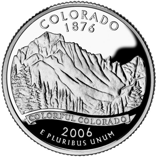
State Quarter
State Bird
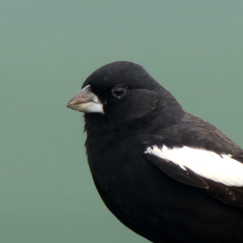 Lark Bunting
State Flower
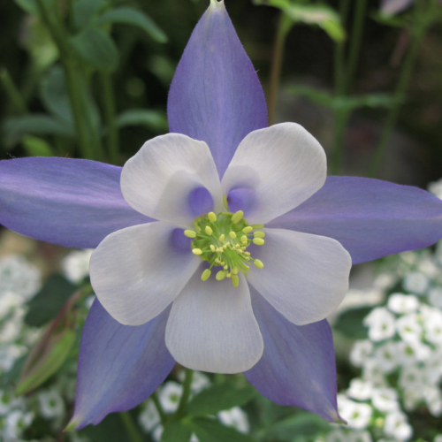 Rocky Mountain Columbine
State Tree
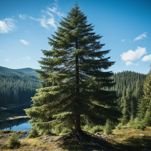 Colorado Blue Spruce
State Mammal
 Rocky Mountain Bighorn Sheep
State Fish
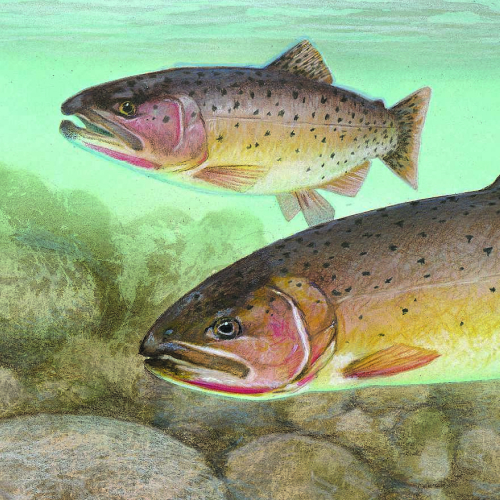 Greenback Cutthroat Trout
State Insect
 Colorado Hairstreak Butterfly

Ted Grajeda
The50UnitedStates.com Owner
The 50 United States is a Ted Grajeda project created to provide everyone with a fun and interactive way to learn about the great 50 states of the USA. Learn more
State Quizzes & Flashcards
Test your knowledge of the 50 States of the USA with these fun and interactive quizzes & flashcards!


Fee USA Maps
Download and printout hundreds of state maps. Each state map comes in PDF format, with capitals and cities, both labeled and blank. Visit FreeVectorMaps.com for thousands of free world, country and USA maps. View all USA Maps